With fellow members of ESRA, we drove in private cars to the Carmel National Park on Israel’s northern coast. Mt. Carmel, with its wild cliffs and green landscapes, is a symbol of beauty close to Israel’s urban areas. Its special characteristics have also made it a part of religious tradition. On Mt. Carmel Elijah performed one of his best-known miracles by bringing down fire from heaven that consumed the pagan sacrifices which had been placed by the priests of Baal on the altar. Following this convincing demonstration of the difference between God and idolatry, the priests were put to death on Elijah’s orders and the Israelites were convinced to turn back to the one, true God (1 Kings 18).
Jews, Druse, Muslims and Christians sanctify Mt. Carmel’s sites, the Carmelite order of Catholic monks bears its name, and Mt. Carmel is also the location of The Shrine of the Báb, the holiest site of the Bahai faith.
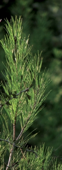
Mt. Carmel is 16 miles long by 4-5 miles wide and 1,800 feet high. The city of Haifa is situated at the western promontory of Mount Carmel and partly at its base, close to smaller Jewish and Druse towns. The park covers 84,000 dunams, one third of which are nature reserves. The national park is entirely dedicated to the protection of Mediterranean nature and landscape, and features forest and woodland species of trees, as well as shrubs, numerous flowers and a variety of wildlife, along with wonderful panoramas and archaeological sites going back to the dawn of humanity. From 1930 to 1932, at Mt. Carmel, Dorothy Garrod excavated Neanderthal and early modern human remains in the “Carmel Caves”, producing a record spanning 600,000 or more years of human activity.
(See www.parks.org.il and http://eraexcellent.co.il for more information.)
Starting from the parking lot adjacent to the artists’ village of Ein Hod, we climbed rapidly up the mountain and soon reached a dramatic scenic overlook. Since Mt. Carmel is located along the Mediterranean seashore, we were treated to a fabulous panorama overlooking the sea. We glimpsed the ruins of the Crusader fort at Atlit, the barracks where the Jewish “illegal immigrants” were imprisoned by the British during the years when terrorized Jews fled the Nazis trying to enter Palestine, and the site of the agricultural research station built by Aaron Aaronsohn, the famous Romanian born Jewish agronomist, botanist, traveler, entrepreneur, and Zionist politician who took up residence in Palestine when it was still a Turkish province. Aaronsohn, who was killed in a plane crash in 1919, is known as the discoverer of wild emmer, which he believed to be "the mother of wheat." He was also the founder and head of Nili, a ring of Jewish residents of Palestine who spied for Britain during World War I.
We continued our slow ascent of the mountain and shortly found ourselves walking alongside limestone cliffs. There are many caves on the mountain, due to the extreme porosity of limestone. We entered one of the caves and were surprised at its size. Since it was pitch black, we used flashlights to illuminate the way. At the cave’s terminus, our guide, Almog, told us to extinguish the lights. We then noticed a source of light coming from a narrow “chimney”, which was only observable from a particular spot.
While walking we saw some of the first winter flowers of the season, in white, pink and yellow hues. We came to a fortified outlook overlooking the sea, in which lookouts were placed to discover Nazi infiltrators coming into Palestine from the sea. Fortifications like this proved unnecessary, however, when the German army was stopped in North Africa.
We then had a steep quarter mile climb up to a plateau below the top of the mountain, where our trail became more level for a time. During most of our hike we alternated between sun and shade and since the temperature was in the low 70s, the conditions were ideal. Almog pointed out a geographical oddity, a vertical “pipe” in the sheer limestone wall adjacent to the trail. Caused by erosion, this pipe is a feature of the cliffs in the area. We ate our lunch at a sunny spot adjacent to a ruined stone domicile, which caused us to wonder who had lived in this isolated spot and when it was built.
Our route through the park is a segment of Israel’s longest hiking trail, the Israel National Trail, a footpath that winds its way from the Red Sea in the south to the Syrian/Lebanese border in the north. The trail crosses the Negev Desert, passes three seas, alongside ancient ruins and through modern cities. About 600 miles long, the trail can be traversed in as short a time as 30 days, but most hikers prefer to do one small stretch at a time, as we were doing. Others hike for several days, either camping on the trail or staying at a nearby B&B, hostel or kibbutz hotel.
On our last leg of the hike, we left the Israel Trail and walked on a level stretch frequented by families and school groups. We followed a stream which originated from a mountain spring, along which were orchards of various fruits, palm trees, and some ancient ruins.
Carmel National Park is one of Israel’s most popular and accessible parks. We were lucky to have hiked there on so perfect a fall day, relatively unhindered by the many casual hikers who park near to the most popular attractions in the park. We could have finished this excellent and at times strenuous hike with a visit to Ein Hod’s artist studios, cafes and galleries, but that will wait for another day.
See page…..for Esra’s next hike.
Post a Comment
Related Articles
 DEAR EDITOR 153
 REVISITING THE PAST BETH HASHOMER
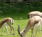 BIBLICAL ZOOS & ANIMAL RESERVES IN ISRAEL
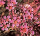 From Australia with Love
 Monkey Tales
 A fresh spirit of Zionism from Manhattan
About the author
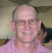 Steve Kramer
Steve Kramer moved to Israel with his wife and two young sons in 1991 from Margate, NJ. After working for years in the beer distribution business in America, Steve had several jobs in Israel before...
More...