
We began our Esra hike at Kibbutz Tsuba, close to the Christian Israeli-Arab town of Abu Ghosh. On the western side of the Judean Mountains and close to Jerusalem, Abu Ghosh is known for both its excellent Middle Eastern style restaurants and its many churches. On Saturdays, the town is packed with Israelis enjoying humus, pita, and the many “oriental” food offerings. At certain times of the year the town attracts large crowds who come to hear concerts performed in the picturesque churches. During the 1948 War of Independence, the townspeople of Abu Ghosh allied themselves with the Jews.
The hike began on the other side of Route 1, at Kibbutz Tsuba. Our excellent guide, Avishai, related the modern history of the highway, which is known as the Tel Aviv-Jerusalem road. Its final route was set after the Six Day War of 1967 when the Jordanian Arab Legion was dislodged from the Latrun fortress at the base of the mountains approaching Jerusalem. The kibbutz is located on the site of an Arab village of the same name. It was built by Israeli fighters and their families in 1948 after the defeat of the local Arab (and Egyptian) fighters during battles for control of the nearby Jerusalem highway.
It is thought that the Arab village was itself built on the remains of a Jewish one, which was settled after the defeat of a Canaanite tribe named Zobah, mentioned in Samuel 1, 14/47: “Now when Saul had taken his place as ruler of Israel, he made war on those who were against him on every side, Moab and the Ammonites and Edom and the kings of Zobah [also Tsuba, Tzuba, Suba] and the Philistines: and whichever way he went, he overcame them.” This serial rebuilding - after military conquest - of villages which retained ancient, similar names, is common in Israel.
After a steep but short climb up towards Tsuba, we stopped at the Belmont (Beautiful Mountain) Fortress to learn about the relatively short Crusader interlude in Palestine which was instigated by Pope Urban II in 1095 to rid Anatolia (modern Turkey) of Muslims. After a short time, taking Jerusalem and the Holy Land from the Muslims and freeing the Eastern Orthodox Christians became the primary goal of the Crusaders. Jerusalem was captured in 1099 and the Kingdom of Jerusalem and other Crusader “states” were established. This area of the Middle East, along the Mediterranean coast, had first come under Islamic rule in the 7th century, when followers of Mohammed surged westward out of the Arabian desert, replacing the Byzantine Christian rulers who had succeeded Rome.
Avishai explained the Arab perspective on the Crusaders who are looked upon as barbarians who forced their culture onto the indigenous population, and who had a totally different way of life, language, religion – and personal hygiene. This viewpoint results in the Arabs describing Jews as “Crusaders”.
After leaving behind the ruins of the fortress and the later Arab village, we descended eastwards through the fields of Kibbutz Tsuba to a small valley full of fruit trees. We continued down Mt. Eitan through the ruins of the Arab village of Sataf, which is an ancient agricultural site in the Judean hills, not far from the Jerusalem neighborhood of Ein Karem.
We followed the path from the upper entrance to Sataf down to the Soreq riverbed, where there are pleasant orchards watered by two springs, one of which flows from a small cave nearby. What’s fascinating here is that the orchards are grown according to the rules of ancient agriculture, with multiple terraces on the steep slope of the hill. There are some old buildings of yellow stone near the springs and the view of almond trees in bloom is fabulous. There are also large caves which were part of the irrigation system.
The 250-acre site is maintained by the Jewish National Fund, and all the work is done by hand or with the help of farm animals, without any machinery or use of pesticides. The site dates back to a Bronze Age village of 4,000 BCE, though most of the ruins are from the Byzantine era. The Arab villagers from Sataf were defeated in the War of Independence, after which there was a short-lived settlement of North African immigrants in that area.
“In 1985, the JNF began the restoration of ancient agricultural practices in the area, with the help of JNF supporters from Switzerland. The primary crops in the Judean Hills in ancient times included vineyards, olives, figs and pomegranates. In this rocky, hilly region, dry farming (which relies only on rainfall for irrigation) was practiced using an elaborate system of terraces and tunnels. The springs here were not plentiful, so the existing water supply had to be maximized. This was achieved by tunneling into the water-bearing strata. An ingenious system of channels (parts of which are clearly visible) conducted the water that was stored in large pools to the terraced plots. Sataf includes a ‘prototype’ vineyard [including] 26 ancient types of vine that were known to have grown in Eretz Israel. … The Sataf also includes a [separate] project called the Bustanof where residents of Jerusalem and its neighboring areas can work plots of land and grow vegetables, flowers etc. (using all the modern technology including irrigation systems with timers – if they so choose).” [www.gemsinisrael.com]
Avishai told us all about this area as we enjoyed our lunch, sitting in the shade of trees, with a massive wall built of boulders towering over us. He explained how deforestation and a fluctuating population (sometimes there weren’t enough people to maintain the agriculture) led to the destruction of the terraces and the resulting loss of soil. We then began the climb up to moshav Even Sapir, noticing how the huge terrace we had rested on had been formed by the construction of the rock wall. The drop from the top of the wall to the level terrace at its bottom was dramatic.
The moshav had been named for Pinchas Sapir, an Israeli pioneer who worked tirelessly to attract foreign investments by personally encouraging businessmen from the Diaspora to invest in Palestine and the nascent state. From there, we had a challenging uphill walk which included a short stint of rock climbing. We eventually reached a path past ancient springs and irrigation systems to the JNF picnic site in the Aminadav forest. From there we had another shorter, uphill climb to the Kennedy Memorial.
The memorial, built shortly after the assassination of the young American president, is a circular building with emblems of all the American states. It is reminiscent of the trunk of a tree which has been cut off, symbolizing the shortened life of America’s storybook president. From this point, we could look across a vista of mountains and valleys back to our starting point. It was the perfect conclusion to a wonderful day.
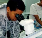 Visit to Michmoret Research Center - Gifted Children's Project
 Esra Kfar Saba Meets Our New Deputy Mayor
 Another glorious evening with pianist Gil Shochat
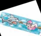 A Matter of Perspective
 A fantastic motor sport adventure – a dream come true
 my sporting year 2007
 Steve Kramer